INTRODUCTION TO TENTSMUIR NATIONAL NATURE RESERVE
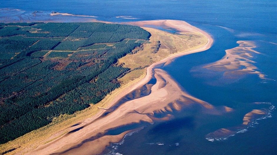
The pressure of climate change on Scotland’s coastline is increasing, and the environmental conditions are only predicted to get worse. A particularly vulnerable area is Tentsmuir Nature Reserve, one of Scotland’s most iconic coasts. This dynamic Reserve is managed by the Scottish Natural Heritage, and covers over 1573 hectares.
What makes Tentsmuir internationally important is its special combination of forest plantation, beach shores and complex sand dunes system. This dynamic environments hosts a wide range of spectacular flora and fauna.
FLORA
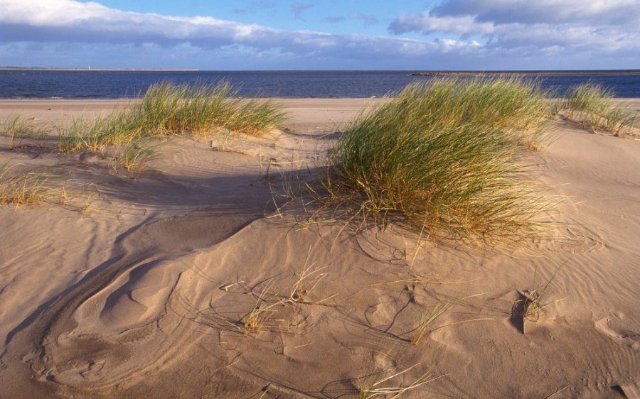
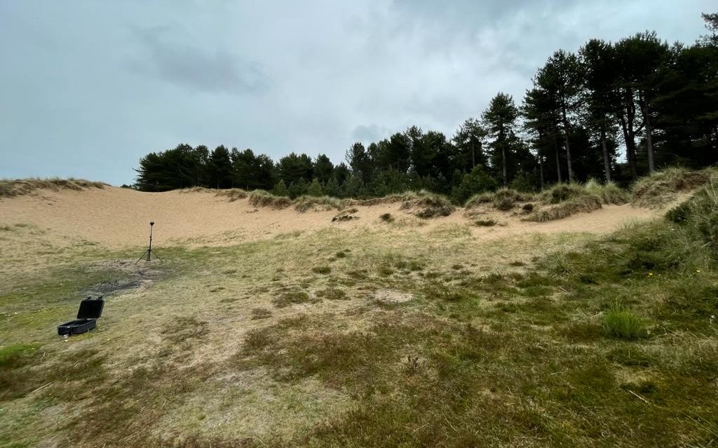
The vigorous movements of Tentsmuir’s sand banks have completely shifted the Nature Reserve’s scenery. Still, they were finally stabilized by marram grass to have the shape they display today.
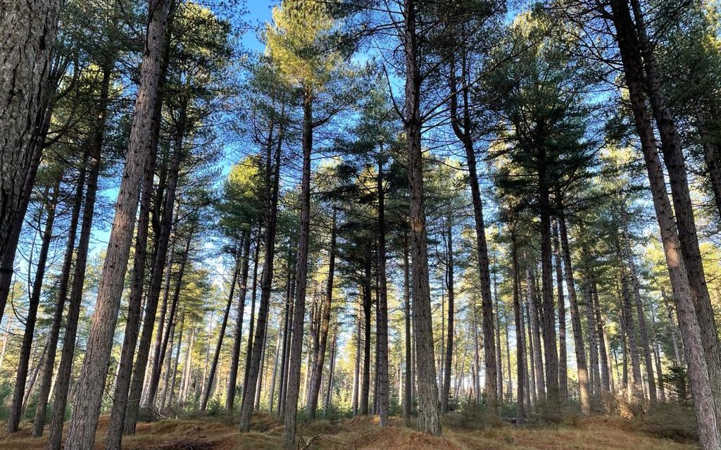
Scots and Corsican pines make up over 62% of the forest, and over 500 species of plants have been identified in the Nature Reserve, making Tentsmuir an ideal place for an abundance of butterfly species. Flowers of regional importance include creeping lady’s tresses, adder’s tongue fern and purple milk vetch. (Forestry and Land Scotland; Scottish Natural Heritage)
FAUNA
Tentsmuir Nature Reserve is not only the home of over 45,000 butterflies, but it also hosts some of Scotland’s most magnificent animals, such as seals, red squirrels, dolphins and birds.
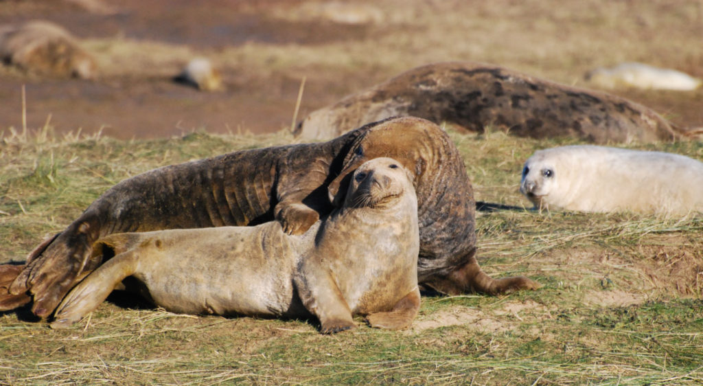
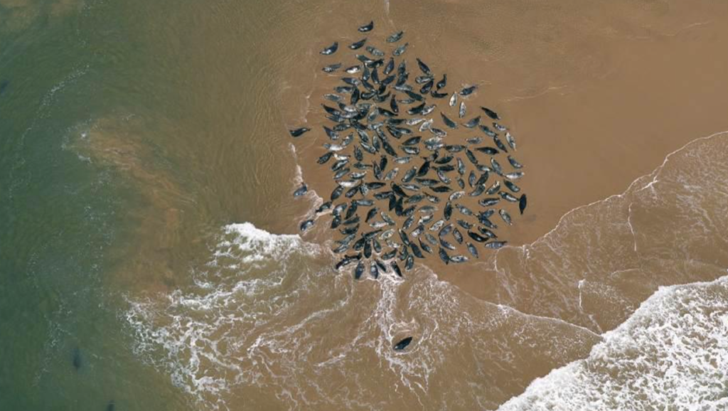
‘It is one of the few places on the east coast of Scotland where both grey and common seals can be seen together. Both types gather by the hundreds on the sandbanks along Tentsmuir Point. Each autumn, thousands of birds flock here to feed and rest during their migration. Up to 12,000 eider ducks gather together between October and March. You may also see pink-footed geese, bar-tailed, godwits, grey plovers and scoters… it is an important habitat for butterflies and other insects. The shoreline supports many bird species.‘
(Scottish Natural Heritage)
GEOLOGY
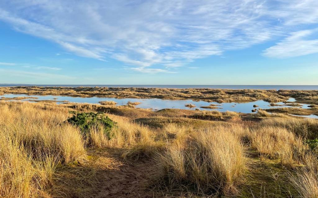
The dune system at Tentsmuir is one of the most dynamic sections of coastline in Scotland, and has undergone many changes during its 100 years of formation. Strong tidal streams significantly shape the sand banks through natural processes of coastal erosion (retreat of the coast) and accretion (advancement of the coast).
Shores with saltmarsh and sand dunes such as Tentsmuir are especially crucial for humanity as they sequester CO2, preventing its release in the atmosphere.
360 TOUR
To immerse yourself into this spectacular environment, we have created a 360 tour of these special habitats:
Link: https://openvirtualworlds.viewin360.co/share/collection/7kv8g?fs=1&vr=1&sd=1&initload=0&thumbs=1&info=0&logo=0
VISUALISING CLIMATE CHANGE MANIFESTATIONS ON TENTSMUIR NATIONAL NATURE RESERVE
Although coastal erosion and accretion are natural processes, climate change is expected to take a toll on Scotland’s coastline. All shorelines are expected to enter a coastal erosion phase, which is being accelerated by rising sea levels, wave heights and precipitation.
The sea-levels in the East of Scotland are expected to rise by 1.0mm each year, amounting to 34-55 cm by the 2080s. Research shows that Tentsmuir Nature Reserve is particularly endangered by this phenomena due to its soft beaches.
(A. Werritty and J. Chatterton, 2004)
The following 360 images are from our 3D computer environment which visualizes how the shores of Tentsmuir, as well as parts of its forest, are going to flood in the future by the year 2100.
Tentsmuir Beach at Present
Tentsmuir Beach in the year 2100
Tentsmuir Forest at present
Tentsmuir Forest by the year 2100
If you have a Microsoft computer, you can experience this 3D tour first-hand by clicking the hashtag #virtual-tour. This will take you to the section of this webpage that explains how to install the 3D application on your PC or laptop.
The parts of the coast and forest expected to flood are visible from the coastal risk screening tool created by Climate central:
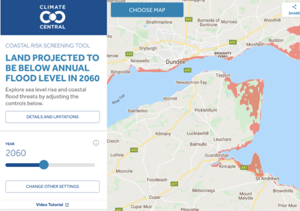
As it can be observed above, Climate Central researchers expect most of the flooding to occur from the side of Tentsmuir adjacent to Tayport and from Tentsmuir point, where the seals gather.
By 2060, the water is predicted to make its way through the rest of the Reserve, leaving the beaches in the North and South East inundated. A significant part of the forest plantation is forecasted to be underwater as well.
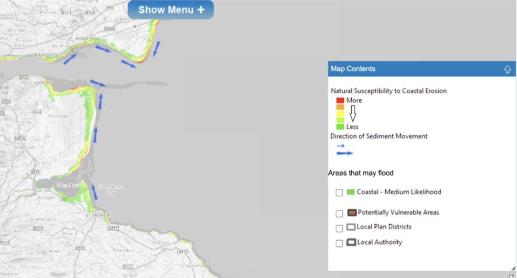
Another renowned interactive map called the Dynamic Coast anticipates that Tentsmuir will suffer from significant erosion. As it can be observed below, the most vulnerable areas are at the North-East and South-East of the Nature Reserve:
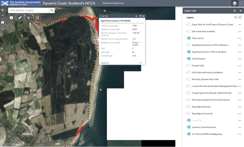
Link to Dynamic Coast Map: https://www.dynamiccoast.com/index
SEPA Flood Risk Management Maps
These findings from the Dynamic Coast project corroborate the research carried out by the Scottish Environment Protection Agency (SEPA).
Their Floor Risk Management Map further illustrate that the North and South of Tentsmuir Nature Reserve have an increased susceptibility to Coastal Erosion.
The map can also be filtered to only illustrate substantial future inundation. This makes it evident that the entire coastal area of Tentsmuir and its adjacent regions have a High Likelihood of flooding in the future.
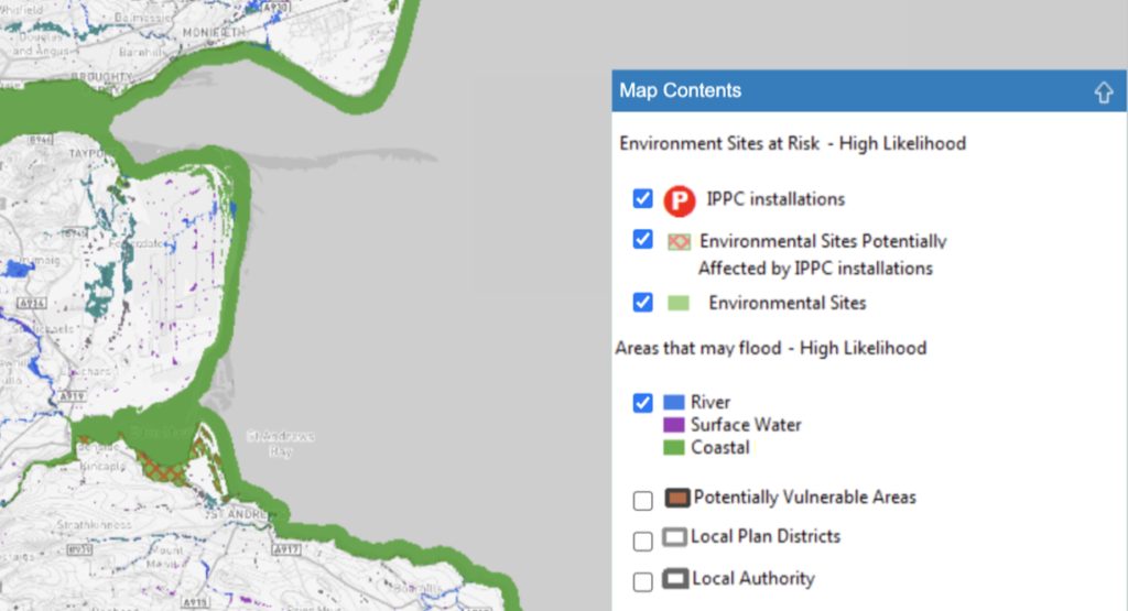
Link to Flood Risk Management Map: https://map.sepa.org.uk/floodmap/map.htm
Although many floods in the UK have been caused by long-duration rainfall, this phenomenon is fairly uncommon to Scotland. The concerns regarding precipitation in Tentsmuir Reserve are high-intensity rainfalls lasting up to two days, and daily and short-duration rainfall. These weather events are expected to become more frequent in the future.
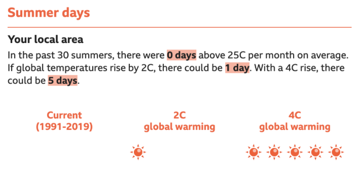
Along with increased precipitation, annual temperatures in Scotland are expected to increase by 3.5-4 degrees Celsius in summer, and by 2 degrees Celsius during winter.
To further understand what this would imply for Tentsmuir Reserve, the climate visualization tool created by the Meteorlogical Office and BBC can be used. Currently, the temperature of the hottest summer day in Tentsmuir area amounts to 28.4C. This is expected to rise significantly depending on different climate change scenarios:

Furthermore, summer days above 25C are expected to become more numerous:
The interaction between this temperature growth and severe rainfall is absolutely crucial for Tentsmuir Reserve. This phenomena would have a compounding effect on precipitation, as warmings in temperatures and precipitation generate water-vapour volumes. These vapours would create a further 15% increase in rainfall for each 1 degree Celsius of warming during autumn, heightening flood risks.
The climate visualization tool further illustrates how much precipitation is expected to increase in Tentsmuir area during summer based on different climate scnearios:
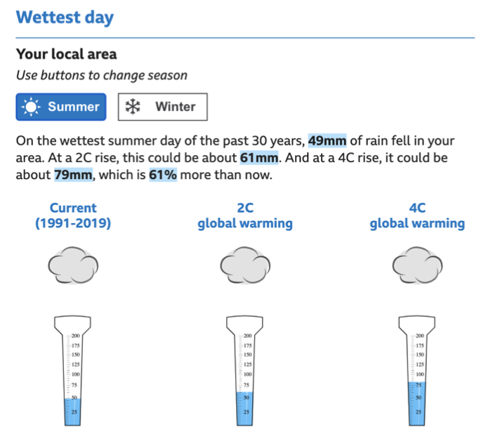
Link to Climate Visualization Tool: https://www.bbc.co.uk/news/resources/idt-d6338d9f-8789-4bc2-b6d7-3691c0e7d138
THE SIGNIFICANCE OF COASTAL EROSION AND FLOODING IN TENTSMUIR
The accelerated erosion of Tenstmuir’s shores would result in tremendous habitat losses. The trees and plants would suffocate, hindering the survival of butterflies and squirrels. The retreating shoreline could no longer host the abundance of seals and birds that gather in Tentsmuir Nature Reserve.What’s more, the crucial shores with saltmarsh and sand would be underwater, unable to sequester CO2. This would pose risks of polluting both the air and water of Tentsmuir’s environment.
The flooding of the Reserve would pose strenuous challenges on the physical and mental wellbeing of coastal communities. These are older and transient populations which tend to have higher unemployment rates due to work seasonality. Inundations would damage the transport networks surrounding Tentsmuir, which would hinder tourists and people’s social activities. This would severely enhance the isolation of the coastal populations surrounding Tentsmuir.
What’s more, buildings and heritage sites are also expected to deteriorate. Particularly in Fife, approximately 3000 properties were identified to be threatened by coastal flooding and erosion. The image below presents the numerous heritage sites at risk identified by the SCAPE Trust in Tentsmuir area:
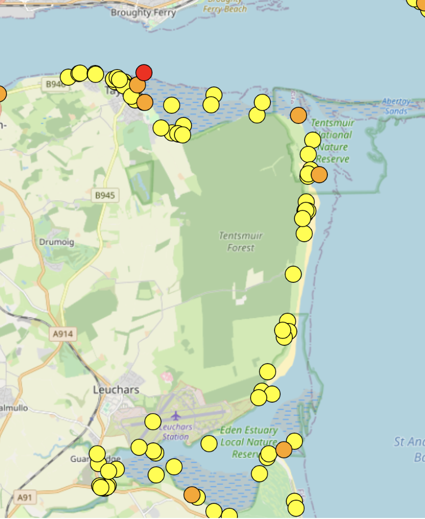
Link of Sites at Risk Map: https://scapetrust.org/sites-at-risk/
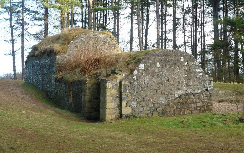
An example of a renowned heritage site of Tentsmuir is the Ice House, which is now the home of numerous bats.
(A. Werritty and J. Chatterton, 2004; Committee on Climate Change, 2017; J.D. Hansom, J.M. Fitton, and A.F.Rennie, 2017; M. Zsamboky et al., 2011)
SURVEY
If you have 5 minutes, please fill in the survey below, as your feedback on this exhibition would be highly valuable to our project. Thank you!
https://standrews.eu.qualtrics.com/jfe/form/SV_esuplUoHxwNnWxo
3D COMPUTER TOUR
Instructions Manual based on a Windows 10 Computer – Implementation may differ based on your computer
Step 1
Please go to the following link to download the virtual environment of Tentsmuir. This should take around 10 minutes.
https://stage.openvirtualworlds.org/unreal/Tenstmuir.zip
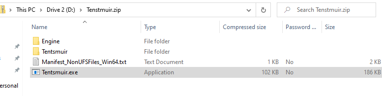
Step 2
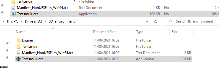
After the download is complete, please click on the last file in the folder and extract all the files, as displayed below::
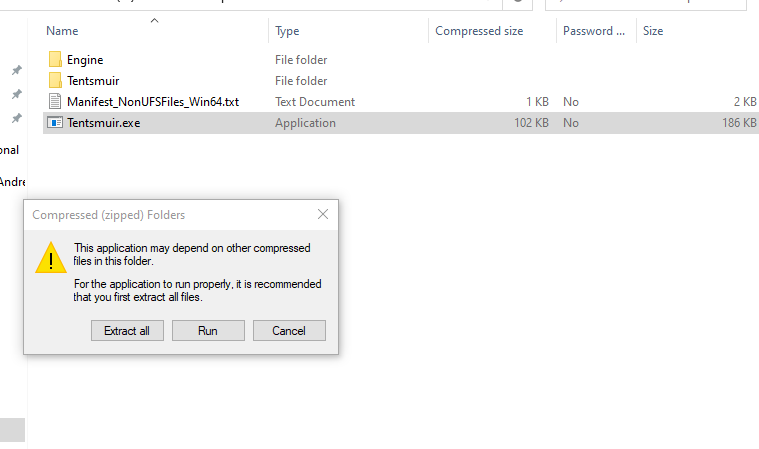
Step 3
Almost done! After the files have been extracted, please open the Tentsmuir.exe application from the folder. This will start the virtual tour for you:
You might also be asked to install some Microsoft plugins in order to run the Unreal Engine 4 application.
Step 4
Well done! Now you are in the virtual environment of Tentsmuir. You can use the mouse and the keyboard arrows or AWSD keys to move around the tour. Please try the following commands in order to interact with the environment:
- G key – this will start flooding the environment to illustrate how Tentsmuir is expected to look like in the future
- H key – reverse the flooding and return to the current state of Tentsmuir
- E key – fly up to have a higher view of the environment
- Q key – fly down
REFERENCES
Links
- Nature.scot. n.d. The Story of Tentsmuir National Nature Reserve. [online] Available at: <https://www.nature.scot/sites/default/files/2018-02/Tentsmuir%20NNR%20-%20The%20Story%20of.pdf>.
- Forestryandland.gov.scot. n.d. Tentsmuir forest design plan – Forestry and Land Scotland. [online] Available at: <https://forestryandland.gov.scot/what-we-do/planning/active/tentsmuir-fdp?fbclid=IwAR07xvEF0obyf0qGvy-r3O3BkHV5sDnXboFm1Sc2T5M7t3AgG0OyXd-evJs>.
- Forestryandland.gov.scot. n.d. Tentsmuir Map and Trail Guide. [online] Available at: <https://forestryandland.gov.scot/images/pdf/rec_pdfs/Tentsmuir-Map-and-Trail-Guide.pdf?fbclid=IwAR17Y2sW5ub4oH3L1KkRzCnkZDLoGJdD5YOku3uO-npeogTjCI_ssvDzjiI>.
- Hansom, J.D., Fitton, J.M., and Rennie, A.F. (2017) Dynamic Coast – National Coastal Change Assessment: Summary, CRW2014/2. [online]. Available at: http://www.dynamiccoast.com/files/reports/NCCA%20-%20Summary%20-%203%20page.pdf
- Fitton, J.M., Rennie, A.F., and Hansom, J.D. (2017) Dynamic Coast – National Coastal Change Assessment: Cell 2 – Fife Ness to Cairnbulg Point, CRW2014/2. [online] Available at: NCCA – Cell 2 – Fife Ness to Cairnbulg Point.pdf (dynamiccoast.com)
- Werritty, A. and Chatterton, J., 2004. Foresight Future Flooding: Scotland. Foresight Future Flooding. [online] GOV.UK. Available at: <https://assets.publishing.service.gov.uk/government/uploads/system/uploads/attachment_data/file/300333/04-948-flooding-scotland.pdf>.
- Committee on Climate Change, 2017. UK Climate Change Risk Assessment 2017 Evidence Report – Summary for Scotland. UK Climate Change Risk Assessment. [online] GOV.UK. Available at: <https://www.theccc.org.uk/wp-content/uploads/2016/07/UK-CCRA-2017-Scotland-National-Summary.pdf>.
- Zsamboky, M., Fernández-Bilbao, A., Smith, D., Knight, J. and Allan, J., 2011. Impacts of climate change on disadvantaged UK coastal communities. Joseph Rowntree Foundation,. [online] Available at: https://www.jrf.org.uk/report/impacts-climate-change-disadvantaged-uk-coastal-communities
Images
Image 3, 5, 6:
Personal photographs
Image 1:
Scottish Natural Heritage, n.d. Aerial view of Tentsmuir Point and Forest with Dundee in background. [image] Available at: <https://www.nature.scot/sites/default/files/2018-02/Tentsmuir%20NNR%20-%20The%20Story%20of.pdf?fbclid=IwAR15EzHN3xakE3T4MaBhVFW4Pyy7sRCROVL_835oXdMVx1CkXph9XZHoTIw>.
Image 2:
Scotland’s Nature, 2017. Sand dunes and Marram grass at Tentsmuir NNR © Lorne Gill. [image] Available at: <https://scotlandsnature.blog/2017/11/22/25-years-of-snh-reserve-manager-at-tentsmuir-nnr/tentsmuir-02-jpg/>.
Image 4:
Walkhighlands, 2021. [image] Available at: <https://www.walkhighlands.co.uk/fife-stirling/tentsmuir.shtml>.
Image 7:
Scottish Natural Heritage, n.d. Grey Seals hauled out on the sandbanks at Tentsmuir. [image] Available at: <https://www.nature.scot/sites/default/files/2018-02/Tentsmuir%20NNR%20-%20The%20Story%20of.pdf?fbclid=IwAR15EzHN3xakE3T4MaBhVFW4Pyy7sRCROVL_835oXdMVx1CkXph9XZHoTIw>.
Image 8:
2011. Ice House, Tentsmuir Forest. [image] Available at: <https://www.flickr.com/photos/garlies/5369827896>.
Welcome to Stage Sites. This is your first post. Edit or delete it, then start writing!