The sinking Venice.
Venice is a world-class cultural heritage. Its unique waterway environment has shaped its historical context. However, due to climate change, the waterways on which the city of Venice depends are gradually submerged. In order to convey this to more people, I designed mobile app to record water levels’ change in Venice.
Background Introduction
Flooding in Venice is nothing new. The Venetian lagoon is over 500km2 in total, but has an average depth of just one metre. High tides and storms can have a severe impact on this kind of wetland environment.
Then there is the city itself, built on wooden pillars driven deep into the lagoon mud. The lowest part of St Mark’s Square is just 55cm above the current average sea level.
When considering why flooding in Venice may be getting more extreme, it’s important to remember both that sea levels are rising and that Venice is sinking.

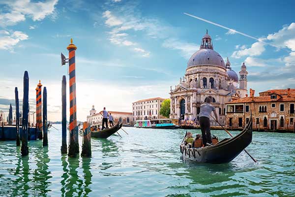
As Venice’s buildings sink,
the floodwaters rise
Photo by Cristina Gottardi on Unsplash
Inspiration: the sinking clues in the art
The tide gauges have recorded the sea level of Venice for 150 years, but if we want to travel further back in time to find out how rising sea levels have affected this city, how should we do?
One climate scientist turned to a surprising source: paintings. “At high school I studied art and, of course, the work of Canaletto,” explains Dario Camuffo, researcher at the Institute of Atmospheric Science and Climate in Padua. “I learned how the artist used a camera obscura to create highly accurate views of Venice.”
In Cannalrtto’s art work, he always use the camera obscura to trace the outline of a scene before painting the final work. Canaletto’s use of the camera obscura, Camuffo suggests, helped the artist produce his highly accurate views of the city.
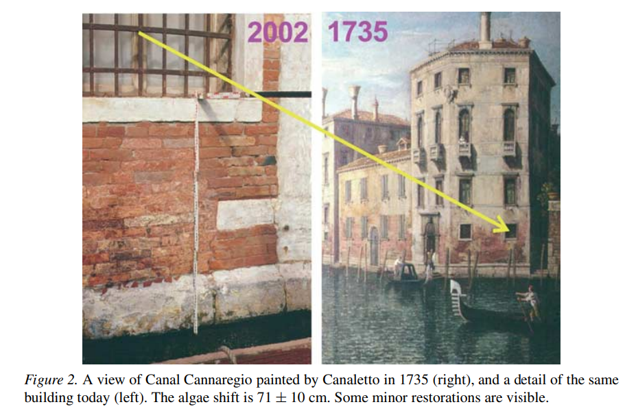
To produce a scientifically reliable representation of the city, Camuffo find something in the paintings that was independent from the tides, the algae. Algae is visible in many paintings of Canaletto, as well as in the work of his nephew and pupil Bernardo Bellotto. This allowed Camuffo to take multiple measurements from different artworks, then compare his findings with the levels found on the same buildings in Venice today.
“Canaletto and Bellotto were extremely precise, reproducing not only the contours of the buildings, but also all details, eg stone by stone, or small damages on the facades, pollution stains or biological infestations,” Camuffo wrote in a 2010 paper. “In this way it was possible to assess levels, heights and measure distances in a quantitative way. Steps in the staircase from the canals, wall decorations or rows of stones made possible a reasonably accurate measurement of the level reached by the sea at that time.”
invite
tourists
to
measure
project concept
Architecture as measuring scale
Venice, a world-renowned tourist destination, attracting tens of thousands of tourists from all over the world every year. According to statistics, there were 1.4 million international tourist arrivals in Venice in 2021, increasing from 0.92 million in 2020. A 2015 student paper states that Venice spends 74.4 million euros on its tourism industry per year. In exchange, it generates around 2.3 billion euros in revenue.
When these tourists walked in the streets of Venice, most of them did not realize that the city of Venice under their feet was gradually sinking, but some tourists could feel this from the side, because the main attraction of Venice, San Marco The lowest point of the square is only 55 centimeters higher than the current mean sea level, and the entire Piazza Venezia is prone to flooding in rainy weather, which has become more and more frequent in recent years. This is a novelty for tourists, but it is very troublesome for local residents.
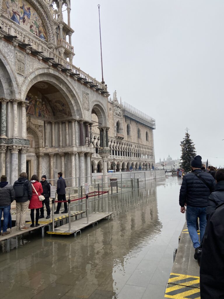
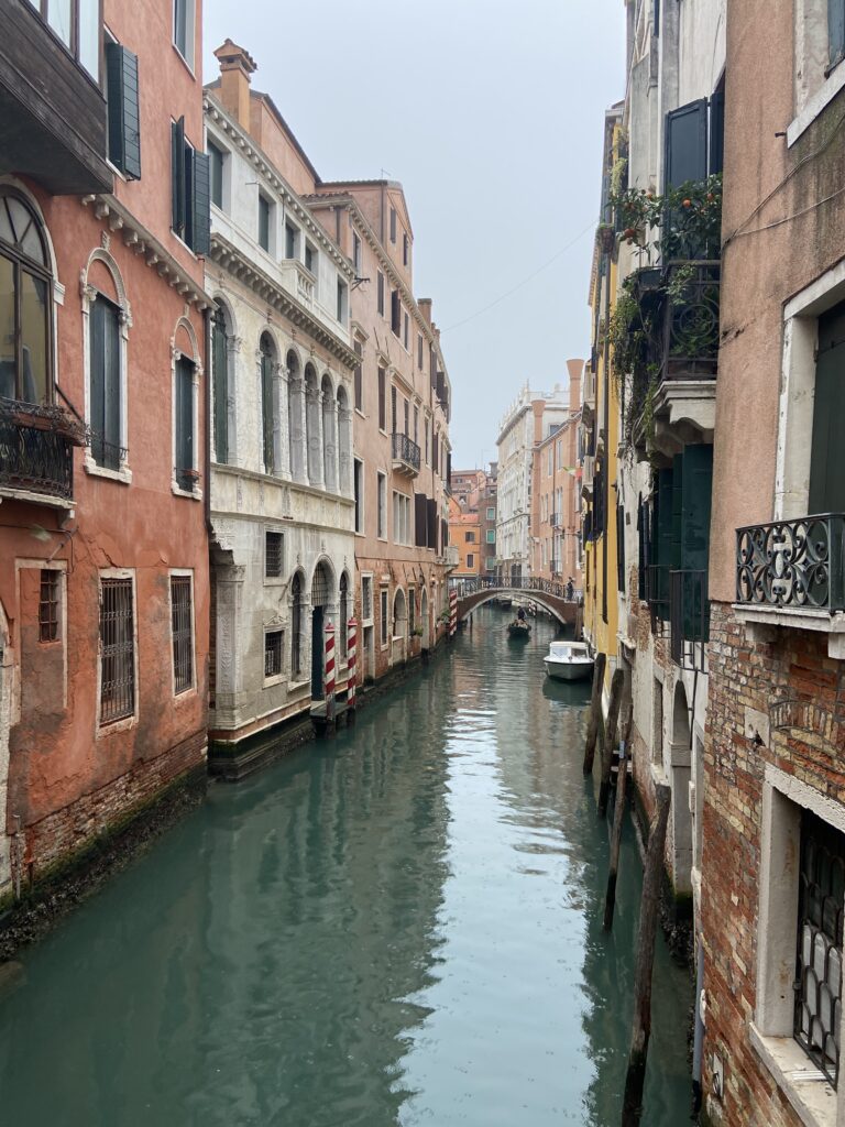

Venice is always at the forefront of the battle against climate change. The goal of my project is to convey the reality that Venice is sinking to more people, and the tourists who have traveled here in person are a very large group, and they have experienced the city first-hand, which will make this fact more touching to them, so that Can more effectively awaken their environmental awareness.
Project specification
Combined with the clues of water level measurement mentioned above, we can find that the architecture of Venice is not only a unique scenic spot, but also a scale for measuring water level. People will produce a large number of video records when traveling, and these convenient photography techniques can easily record this kind of water level. Unique measurement, if some tourists participate in this measurement, then enough measurement pictures can be aggregated into water level data.
Based on these inspirational projects, a mobile phone application is designed. After entering Venice, tourists can download this software and use GPS technology to check in at the designated location. The standard for checking in is to upload a photo of the building and water level at the designated location. Then, through image recognition technology and big data calculation, the software will give a reminder of the relative fluctuation of the water level, and tourists can compare it with the previous water level photos at the same location.
This project combine tourist experiences, environmental education, and the protection of Venice to create a set of experience designs centred around a mobile phone application that helps tourists better visit Venice and make a small contribution to its protection. I believe this project proposal is beneficial to the sustainable development of the city.
If the project is successfully implemented, it can open up several opportunities for further development. For example, incorporating AR functionality and personalized tour route planning can enhance the app’s interactivity and user experience. This project can also be used as a research platform to collect data for water level analyse in Venice.
It needs to be noticed that the mobile app prototype only meets the basic requirements of the interactive prototype mentioned in the project. It is mainly for showing and testing interaction of prototype, the media and data information is not guaranteed to be accurate. It demonstrates the main functions required for the project, but additional interactive transitions will need to be added to make it a complete software design.
start a journey in Venice