
Introduction
Welcome to the HMS K-4 and K-17 Submarine Wrecks Digital Exhibit! Here, you can immerse yourself with a virtual map and timeline detailing the events of the Battle of May Island. This page also explores the effects of climate change on underwater heritage sites as a whole, and the current efforts in preserving the HMS K-4 and K-17 submarine wrecks.
The wrecks are off the eastern coast of the Isle of May (May Island), which is a little island off of the southeastern coast of Scotland. A memorial for the submariners that lost their lives in the Battle of May Island is located in Anstruther. Even though the event is called the “Battle” of May Island, it was actually a Royal Navy Fleet exercise to practice “fleet submarine” tactics (incorporating submarines with surface ships in fleet operations). A combination of factors (K-class submarine flaws, radio communication delays, etc.) led to a disastrous sequence of events. Within about an hour and 15 minutes, the damage report consisted of:
- 5 collisions between 8 ships
- 2 K-class submarines lost
- 4 K-class submarines damaged
- 1 light cruiser damaged
- 104 submariners died (+1 who passed away later from sustained injuries)
Virtual Map
If the virtual map is not embedded below, access it using this link: https://www.google.com/maps/d/embed?mid=1HwKGZhsGFIBansEBRUd33Ce_wdE7MRU&hl=en&ehbc=2E312F.
Storyboards
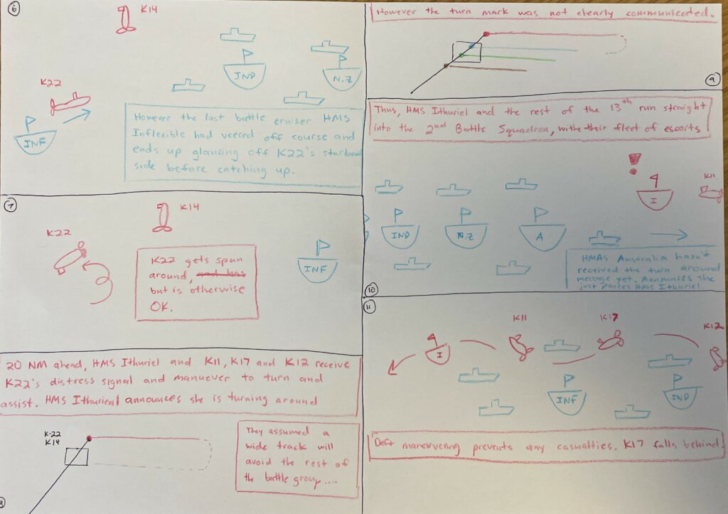
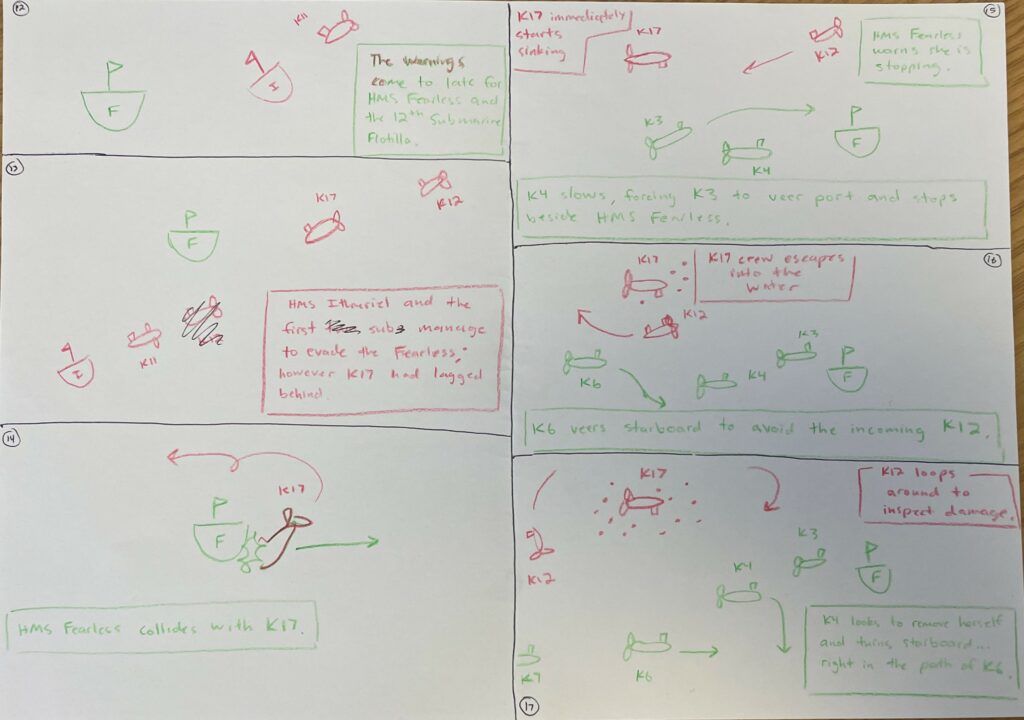
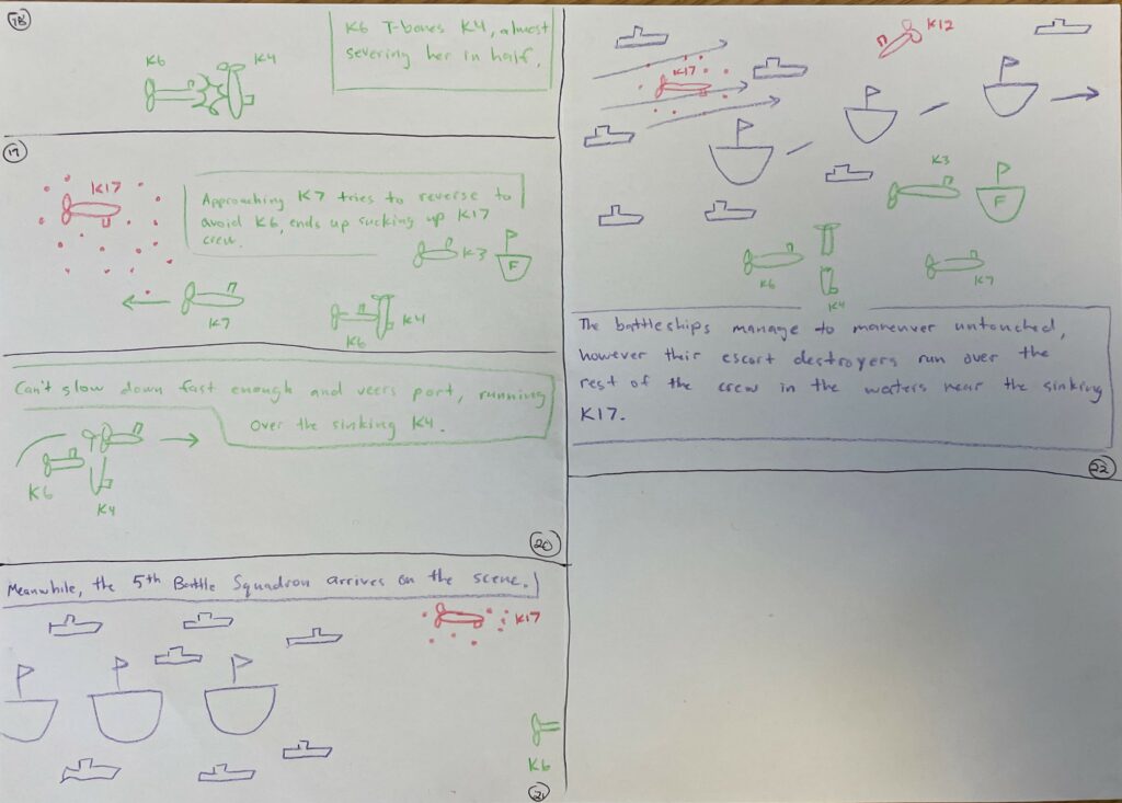
These storyboards detail the close-up events pertaining to the Battle of May Island. You can see the integration of these storyboards in the interactive Google Maps linked above.


Timeline
The timeline below is a consolidated sequence of events. Discrepancies between multiple sources were corroborated and resolved by the author of this page.[1],[2],[3],[4] The color code for the timeline is as follows: light pink – contextual information, yellow – main events, blue – events leading up to the main events (secondary events), red – collisions or events that lead to physical damage, green – radio messages. Radio messages were included because transmission delays were a large factor in why the Battle of May Island turned out the way it did.
If the timeline is not embedded below, access it using this link: https://miro.com/app/embed/uXjVMNUNlGQ=/?pres=1&frameId=3458764553267866514&embedId=945063085559.


Submarine Wreck Dives
Videos of the HMS K-4 and K-17 submarine wrecks are embedded below.
Climate Change
According to the United Nations Educational, Scientific and Cultural Organization (UNESCO), underwater heritage sites are threatened by six main factors: economic activities, commercial exploitation, pillages, climate change, seabed developments and trawling and fishing activities.[5] An emphasis on climate change and its effects on the HMS K-4 and K-17 submarine wrecks from the Battle of May Island, as well as potential responses to monitor, mitigate, adapt and communicate its effects are listed below.

Impacts on Underwater Heritage Sites
| Warming of the waters | Precipitates increase chemical changes which occur at higher temperatures; thus, increasing the rate of deterioration of submerged heritage sites. In addition, temperature changes can affect the ecosystem around the wreck, introducing new biological species (that can degrade the wreck) or killing off old ones (that may have stabilized the wreck, example: seagrass[6]). |
| Ocean currents | Disturb the layers of sediment formed by the interaction of microorganisms, rust and seawater. These layers act as a protective barrier from waves and currents, preventing further alteration of the wreck. Currents can also displace and disperse components of the wreck, or move them away from the original site altogether, decontextualizing the wreck from its origin. |
| Chemical changes | The ocean’s acidity and pH occur because of increased levels of atmospheric carbon dioxide. As the ocean absorbs more carbon dioxide, oxygen levels increase and seawater pH decreases; thus, the ocean becomes more acidic and corrosive to underwater heritage sites. |
| Rising sea levels | Increasing the depth at which the wreck lies, which increases the amount of pressure it is under. In addition, rising sea levels increase the potential of more violent storms, which can displace and further damage underwater heritage sites. |

Climate Change Responses
A simple climate change response framework to analyze the ongoing work and research to preserve underwater heritage sites is depicted below.[7] The goal of this framework is to better categorize the various responses addressing the impacts of climate change on underwater heritage sites.
Monitor
Monitor climate change effects on underwater sites to inform an effective response.
- Interdisciplinary approaches and cooperation across fields, where archaeologists, biologists, ecologists, oceanographers, and other scientists with more knowledge on how changing climate can affect ecosystems are sharing data.[6] The 2001 UNESCO Convention on the Protection of Underwater Cultural Heritage outlines this need for cooperation and information-sharing in Article 19.1.[5]
- Site protection and supervision through sonar buoys that warn incoming vessels and can be tripped to activate and alert protective or surveillance technology. Satellite supervision of underwater cultural heritage zones are also capable of high-resolution images that can map and identify vessels.[5]
- Inventorying underwater cultural heritage sites to locate, prioritize and inform preservation strategies unique for each site.[5],[8],[9]
Adapt
Adapt to climate change by utilizing existing technologies.
- Physical efforts such as partially reburying wrecks with sandbags and sediment, fabric covers and nets, and protective metal nets and cages are forms of physical protection that help slow down further decay.[5]
- Digital efforts using a combination of satellite imagery, marine environment databases, drones, photogrammetry and marine geophysics allow for difficult to reach heritage sites (like underwater heritage sites) be accessible and preserved through virtual dives, 3D models, exhibits and videos.[8]
Communicate
Communicate the impact of climate change to motivate societal change.
- Encouraging citizens to partake in underwater heritage preservation efforts allows for a citizen science monitoring approach to observing and monitoring submerged sites, as well as raises awareness and motivates individuals to take an active part in preserving the site.
- Digital preservation efforts like exhibits make underwater heritage sites more accessible to the public, fostering interest and encouraging individuals to engage in sustainable action.[6],[8],[9]
MONITOR
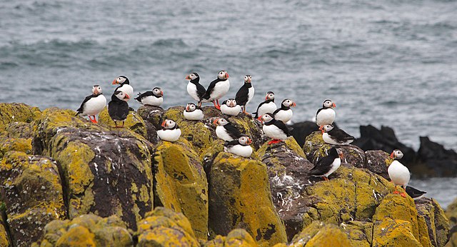
- The approximate location of the submarine wrecks was known to be in the vicinity of the Isle of May, the proposed site of Neart na Gaoithe’s (NnG) new offshore wind farm. As part of their pre-construction survey in 2011, NnG found the exact location of the wrecks in order to ensure the wind farm’s construction did not interfere.[10] The company has been working closely with Wessex Archaeology (WA) to hand over any jurisdiction regarding archaeological material collected. This archaeological data has also been shared with the non-profit organization Breaking Heritage (BH) which seeks to engage volunteer veterans in archaeological projects.
- As a result of the 2011 pre-survey by NnG, the submarine wrecks have been designated as Protected Places under the Protection of Military Remains Act 1986, which permits diving but on a “’look but don’t touch’” basis.[11]
- Historic Environment Scotland (HES) has a large online database of Scotland’s historic environment called Canmore. This database is accessible to the public and its records from different organizations, communities and individuals are compilations managed by HES. The K-4 and K-17 submarine wrecks are included in this database.
MITIGATE
- The 1972 Convention Concerning the Protection of the World Cultural and Natural Heritage sought to erase the “nature and culture dichotomy” asserting that accommodating cultural heritage in environmental policies also preserves natural heritage.[9] In line with this effort, Historic Environment Scotland (HES), has set forth a Climate Action Plan for 2020-2025, which details their plan to use Scotland’s historic environment to inspire climate action.
ADAPT
- The submarine wrecks have been digitally charted and imaged by EMU Limited and Headland Archaeology, commissioned by Mainstream Renewable Power. Wessex Archaeology Scotland have had access to high resolution marine geophysics from NnG Offshore Wind Limited, who they have cooperated with to build up multibeam images using bathymetry and side-scan sonar data. WA are collaborating with Breaking Ground Heritage[12] (BGH) to use this archaeological material as part of Operation Nightingale, where there is an ongoing project concerning photogrammetrically 3D-modelling the K-4 and K-17 wrecks.[13] There are also videos of K-4 and K-17 submarine dives.[14]
COMMUNICATE
- Historic Environment Scotland offers advice and support to the public interested in conserving Scotland’s marine heritage, including how to get involved, who to contact, how to report an object or wreck and licensing obligations.[15]
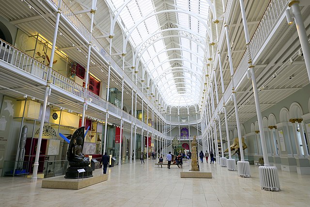
- This site and interactive map hope to communicate a historical event that has been held secret by the Royal Navy until 1994, about 75 years after the event. Paired with the existing wreck dive videos and 3D modelling, this exhibit hopes to add some context (why and how) to the submarine wrecks (the what). The interactive map and storyboard demonstrate the conditions and ship maneuvers that precipitate the chaotic sequence of events. In addition, highlighting the effects of climate change on underwater heritage sites in this exhibit is an effort to spread awareness of how people can help protect marine heritage and resources for them to explore if they wish to be involved.
References
[1] Battle of May Island – Wikipedia
[2] A First World War tragedy off the coast of Scotland – Scottish Field
[3] The K Boats (scottishshipwrecks.com)
[4] The Battle of May Island | Down the Rabbit Hole – YouTube
[5] Practical Measures of Protection (unesco.org)
[6] Climate Change Is Coming for Underwater Archaeological Sites | WIRED
[7] IS5110 Coursework Practical 2
[8] Of time and tide: the complex impacts of climate change on coastal and underwater cultural heritage | Antiquity | Cambridge Core
[9] Climate change and underwater cultural heritage: Impacts and challenges – ScienceDirect
[10] “Neart Na Gaoithe (NNG) Offshore Wind Farm.” n.d. NNG Offshore Wind.
[11] “Marine Scotland Information.” 2020. Gov.scot. 2020.
[12] “BGH Online.” n.d. BGH Online. Accessed February 22, 2023.
[13] “Aberlady X-Craft Project | Wessex Archaeology.” n.d. Www.wessexarch.co.uk. Accessed February 22, 2023.
[14] “HMS K4 the Battle of May Island.” n.d. Www.youtube.com. Accessed February 22, 2023.
[15] “Conserving our Marine Heritage: How to Help | Hist Env Scotland (historicenvironment.scot).