Sukur Cultural Landscape:
Nigeria’s First UNESCO World Heritage
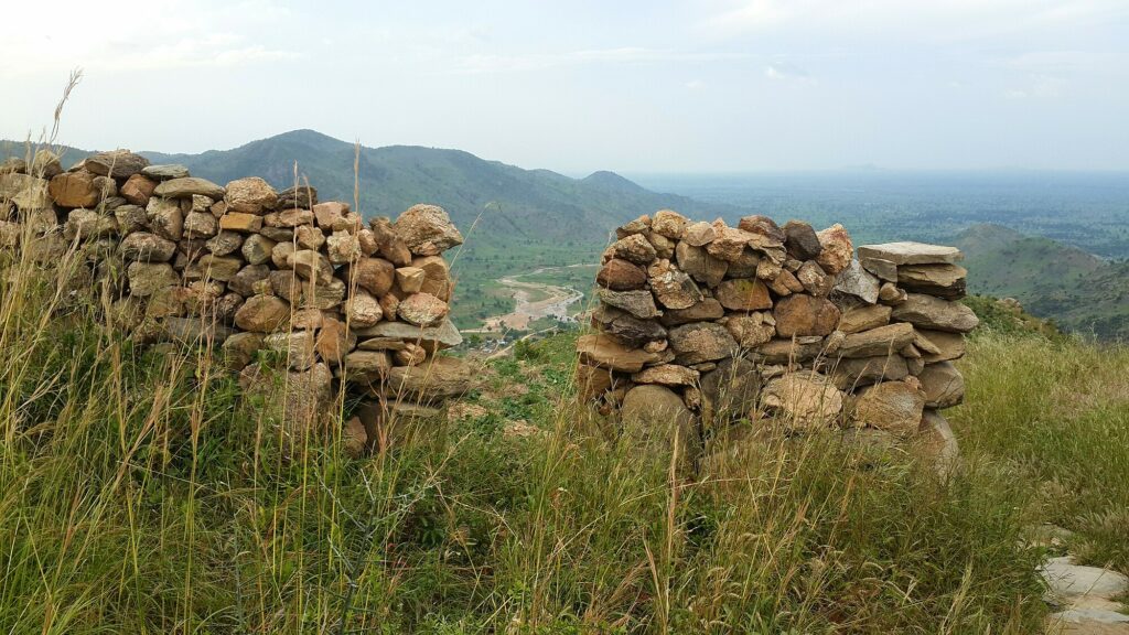
Sukur is a historic town with a rich history that dates to the 16th century and inscribed by UNESCO in 1999. It is known for its developed political systems, robust trading networks, and iron smelting expertise. Sukur’s terrain is distinguished by its paved paths, elaborate dry stone structures, and terraced farmlands.
INTRODUCTION
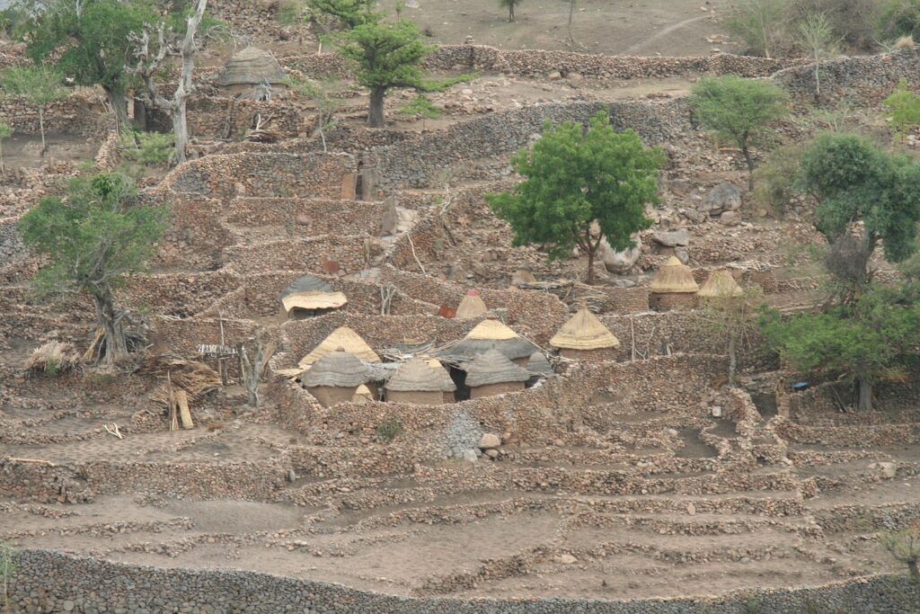
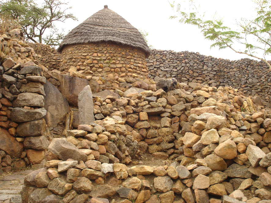
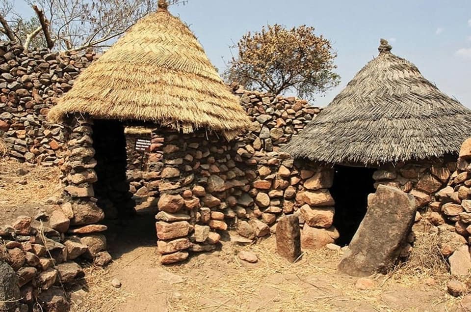
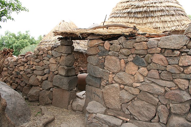
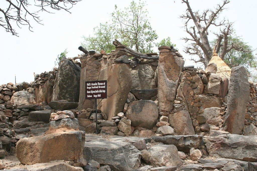
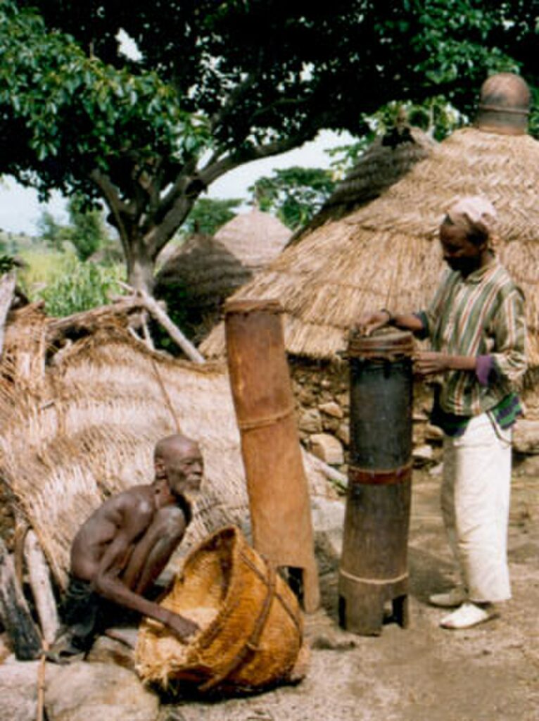
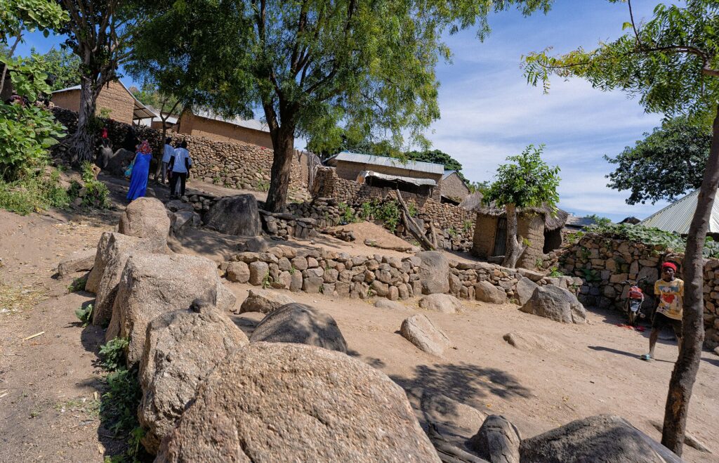
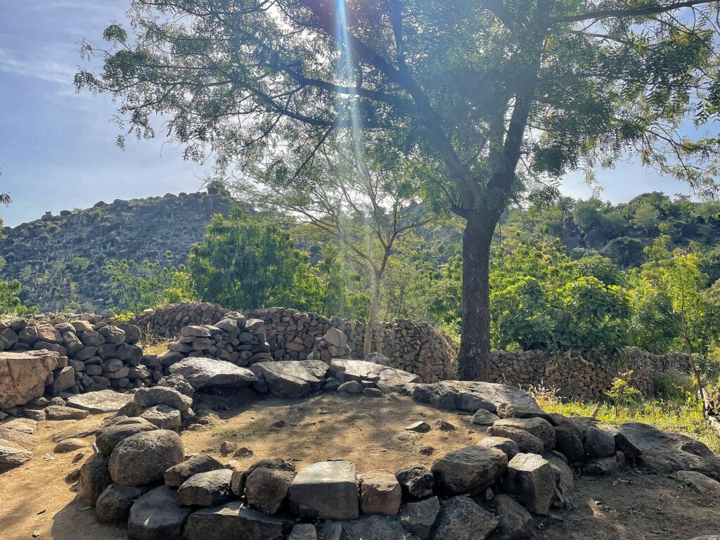
The Sukur Cultural Landscape, a UNESCO World Heritage Site in North-Eastern Nigeria’s Mandara Mountains, is known for its unique architecture characterized by stone houses with thatched roofs, agricultural terraces, iron smelting, and cultural traditions. Its hilltop settlement, centred around the traditional ruler, Hidi’s compound, features stone houses with thatched roofs. Designated by UNESCO in 1999, it showcases a harmonious human-nature relationship and Sukur’s historical trade and iron smelting dominance, evident in disused furnaces scattered across the landscape. The remains of many disused iron-smelting furnaces can still be found across the landscape.These shaft-type furnaces, blown with bellows were typically located near to the owners’ homes.
The landscape has remained unaltered for many centuries, providing a vivid depiction of land utilisation that marks critical stage in human settlement and its relationship with its environment which is one of the criterion for its UNESCO status. The Hidi serves as both political and spiritual leader, with a palace of impressive dry stone architecture. Surrounding shrines, some with ceramics, add to its reverence. Villages below display unique indigenous architecture, with dry stone walls and sunken animal enclosures. The Sukur people practice traditional terraced agriculture on Mandara Mountains, preventing erosion and ensuring food security with staple crops and cultural preservation. The Sukur people practice traditional terraced agriculture, crafting stone terraces on the steep slopes of the Mandara Mountains to cultivate crops. They grow staple cereals like millet and sorghum, alongside legumes, root crops, and vegetables. This agriculture ensures food security, sustains livelihoods, and preserves cultural heritage.
IMPACT OF CLIMATE CHANGE
Climate change poses various challenges to the Sukur Cultural Landscape, which include:
- Alterations in rainfall patterns
- Increased temperatures
- Soil Erosion and land degradation
- Frequent extreme weather events
These changes threaten agricultural productivity, water availability, and ecosystem integrity, impacting the livelihoods of the Sukur community. Climate change worsens biodiversity loss and socioeconomic disparities, leading to greater food insecurity and poverty in the region. Promoting sustainable agricultural practices and water management can address these challenges
SUSTAINABLE DEVELOPMENT GOALS (SDGs)
SDG Goal 13, Climate Action is deeply intertwined with the Sukur cultural landscape. Efforts to safeguard terraced agriculture and preserve natural landscape showcases Sukur’s stance in addressing climate challenges
Sukur’s alignment with SDG Goal 15 underscores its commitment to preserving terrestrial ecosystems and biodiversity within its cultural landscape. Sukur contributes directly to SDG 15’s objective of protecting, restoring, and promoting sustainable use of terrestrial ecosystems. The community actively engages in initiatives aimed at restoring degraded landscapes and promoting sustainable land management practices.
.jpg)
DIGITALISATION OF SUKUR CULTURAL LANDSCAPE
Digitalisation will support efforts to motivate people to take action in support of sustainable development goals and against climate change threats. The digitalisation of the Sukur Cultural Landscape can help to explore the landscape virtually by:
- Utilising digital tools like remote sensing and geographic information systems (GIS) technologies to gather data for sustainable land use planning and climate resilience efforts. This information informs adaptive strategies to mitigate the impacts of climate change, aligning with SDG 13: Climate Action.
- Engaging in biodiversity conservation through digital platforms, mapping habitats and protecting unique flora and fauna, contributing to SDG 15.
- Promoting community participation in sustainable development initiatives using online platforms, fostering collaboration for conservation and resilience, in line with SDG 11.
- Virtual tours would increase accessibility, education, engagement, and promotion of sustainability efforts in Sukur. Through these tours, individuals worldwide can explore and learn about the cultural and environmental significance of Sukur, fostering awareness and support for its conservation and sustainable development initiatives.
VIRTUAL TOUR OF THE SUKUR CULTURAL LANDSCAPE
IMAGE GALLERY OF SUKUR CULTURAL LANDSCAPE
LOCATION OF SUKUR
Click Here to Return to Top of Exhibition
IMAGE SOURCES
Note: All images used in this prototype are either from public domains or under creative commons license